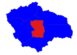
Thayet Township
သရက်မြို့နယ် | |
|---|---|
 Location in Thayet district | |
| Coordinates: 19°19′N 95°05′E / 19.317°N 95.083°E | |
| Country | |
| Region | Magway |
| District | Thayet |
| Capital | Thayetmyo |
| Time zone | UTC+6.30 (MST) |
Thayet Township (Burmese: သရက်မြို့နယ်) is a township of Thayet District in the Magway Region of Burma (Myanmar). It lies on the west side of the Irrawaddy. The major town and administrative center is Thayet. Notable peaks are Mount Myinba (1688 ft.) and Mount Myinmagyi (1032 ft.).[1]
- ^ topographic map, 1:250,000 Burma 1:250,000 topographic map, Series U542, Thayetmyo NE 46-4, United States Army Map Service, October 1959
