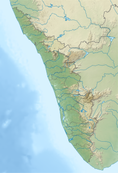
| Thenmala Dam | |
|---|---|
 Thenmala Dam | |
| Official name | Kallada dam |
| Country | India |
| Location | Thenmala, Kollam, Kerala |
| Coordinates | 8°57′14″N 77°4′11″E / 8.95389°N 77.06972°E |
| Purpose | Irrigation |
| Status | Operational |
| Opening date | 1986 |
| Dam and spillways | |
| Height | 85.35m |
| Length | 335m |
| Spillways | 3 |
| Spillway type | Ogee with radial gate auxiliiary- Labyrinth |
| Reservoir | |
| Total capacity | 524,000,000 m3 (424,814 acre⋅ft) Maximum Water Level 115.82 metres, 380.0 ft |
| Active capacity | 507,000,000 m3 (411,032 acre⋅ft) |
| Catchment area | 549 km2 (212 sq mi) |
| Surface area | 23 km2 (9 sq mi) |
The Thenmala Dam also known as Parappar Dam is part of the largest irrigation project in Kerala, India. It is built along Kallada River in Kollam district of Kerala. The reservoir is used for irrigation and power generation.
The dam project started in 1960's under the Kallada Irrigation and Tree Crop development project.[1] The foundation stone of the dam was laid by T. K. Divakaran on 26 January 1972. It was completed in 1986 and was commissioned on 26 May 1986 by K. Karunakaran along with Kallada Irrigation Project. The reservoir is now a part of Thenmala Ecotourism Project.[2]
- ^ "Announcement of World Bank and IDA to Support First Irrigation Project in India Using Underground Plastic Pipes on June 28, 1982". World Bank. Retrieved 30 May 2024.
- ^ "Thenmala - India's first planned Ecotourism destination, Kollam". Kerala Tourism. Retrieved 30 May 2024.

