| Theodul Glacier | |
|---|---|
| Theodulgletscher, Glacier du Théodule | |
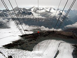
 The Upper Theodul Glacier (left) and the Lower Theodul Glacier (right) from the Klein Matterhorn cable car | |
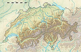
| Location | Valais, Switzerland |
| Coordinates | 45°56′40″N 07°43′00″E / 45.94444°N 7.71667°E |
| Terminus | 2,500 metres (8,202 ft) |
| Status | Retreating |
The Theodul Glacier (also spelled Theodule Glacier; German: Theodulgletscher, French: Glacier du Théodule, Italian: Ghiacciaio del Teodulo) is a glacier of the Alps, located south of Zermatt in the canton of Valais. It lies on the Swiss side of the Pennine Alps, although its upper basin touches the Italian region of the Aosta Valley. The glacier descends from the west side of the Breithorn (4,164 metres (13,661 ft)) and splits into two diverging branches above Gandegg: the Upper Theodul Glacier (Oberer Theodulgletscher), spilling on a high plateau near Trockener Steg, together with the Furgg Glacier, and the Lower Theodul Glacier (Unterer Theodulgletscher), reaching a height of about 2,500 metres (8,202 ft) above the Gorner Glacier.


