Thep Sathit
เทพสถิต | |
|---|---|
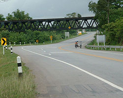
 The railway bridge of northeastern rail route crosses over Suranarai Road in Thep Sathit | |
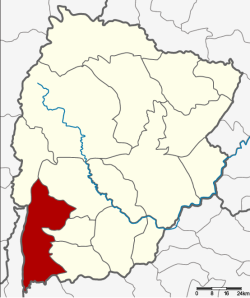
 District location in Chaiyaphum province | |
| Coordinates: 15°23′30″N 101°27′0″E / 15.39167°N 101.45000°E | |
| Country | Thailand |
| Province | Chaiyaphum |
| Seat | Wa Tabaek |
| Area | |
• Total | 875.6 km2 (338.1 sq mi) |
| Population (2005) | |
• Total | 65,735 |
| • Density | 75.1/km2 (195/sq mi) |
| Time zone | UTC+7 (ICT) |
| Postal code | 36230 |
| Geocode | 3609 |
Thep Sathit (Thai: เทพสถิต, pronounced [tʰêːp sā.tʰìt]) is a district (amphoe) in the southwestern part of Chaiyaphum province, eastern Thailand.