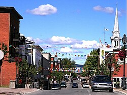
Thetford Mines | |
|---|---|
 City centre | |
| Motto(s): | |
 Location within Les Appalaches RCM | |
| Coordinates: 46°06′N 71°18′W / 46.1°N 71.3°W[1] | |
| Country | |
| Province | |
| Region | Chaudière-Appalaches |
| RCM | Les Appalaches |
| Founded | 1876 |
| Constituted | October 17, 2001 |
| Government | |
| • Mayor | Marc-Alexandre Brousseau |
| • Federal riding | Mégantic—L'Érable |
| • Prov. riding | Lotbinière-Frontenac |
| Area | |
• City | 227.70 km2 (87.92 sq mi) |
| • Land | 225.97 km2 (87.25 sq mi) |
| • Urban | 17.43 km2 (6.73 sq mi) |
| • Metro | 405.92 km2 (156.73 sq mi) |
| Population | |
• City | 26,072 |
| • Density | 115.4/km2 (299/sq mi) |
| • Urban | 20,312 |
| • Urban density | 1,165.3/km2 (3,018/sq mi) |
| • Metro | 28,287 |
| • Metro density | 69.7/km2 (181/sq mi) |
| • Pop 2016–2021 | |
| • Dwellings | 13,059 |
| Demonym(s) | Thetfordois, Thetfordoises (Fr); Thetforder (EN) |
| Time zone | UTC−5 (EST) |
| • Summer (DST) | UTC−4 (EDT) |
| Postal code(s) | G6G & G6H |
| Area code(s) | 418 and 581 |
| Highways | |
| Geocode | 24 31084 |
| Website | www |
Thetford Mines (Canada 2021 Census population 26,072) is a city in south-central Quebec, Canada. It is the seat of Les Appalaches Regional County Municipality. The city is located in the Appalachian Mountains, 187 km east-northeast of Montreal and 79 km south of Quebec City.[5] It is known mostly as the asbestos capital of Canada.[6]
- ^ Cite error: The named reference
toponymiewas invoked but never defined (see the help page). - ^ a b Cite error: The named reference
mamrotwas invoked but never defined (see the help page). - ^ a b Cite error: The named reference
cp2021was invoked but never defined (see the help page). - ^ a b Thetford Mines (Census agglomeration), Quebec 2021 Census Profile. The census agglomeration consists of Thetford Mines, Saint-Adrien-d'Irlande and Saint-Joseph-de-Coleraine.
- ^ Thetford Mines, thecanadianencyclopedia.ca
- ^ A Stadium Reborn in Thetford Mines, stadiumjourney.com

