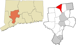
Thomaston, Connecticut | |
|---|---|
| Town of Thomaston | |
 Autumn 2003 view of Thomaston from Plymouth | |
| Motto: "A Town For All Time..."[1] | |
| Coordinates: 41°40′15″N 73°04′57″W / 41.67083°N 73.08250°W | |
| Country | |
| U.S. state | |
| County | Litchfield |
| Region | Naugatuck Valley |
| Incorporated | 1875 |
| Government | |
| • Type | Selectman-town meeting |
| • First selectman | Edmond V. Mone (R)[2][3] |
| • Selectman | Michael Burr (R) |
| • Selectman | Jeffrey Dunn (D) |
| Area | |
| • Total | 12.2 sq mi (31.6 km2) |
| • Land | 12.0 sq mi (31.0 km2) |
| • Water | 0.2 sq mi (0.6 km2) |
| Elevation | 446 ft (136 m) |
| Population (2020) | |
| • Total | 7,442 |
| • Density | 622/sq mi (240.1/km2) |
| Time zone | UTC-5 (Eastern) |
| • Summer (DST) | UTC-4 (Eastern) |
| ZIP codes | 06787 |
| Area code(s) | 860/959 |
| FIPS code | 09-75730 |
| GNIS feature ID | 0213515 |
| Website | www |
Thomaston is a town in Litchfield County, Connecticut, United States. The town is part of the Naugatuck Valley Planning Region. The population was 7,442 at the 2020 census.[4] The urban center of the town is the Thomaston census-designated place, with a population of 1,928 at the 2020 census.[5]
- ^ "Town of Thomaston Connecticut". Town of Thomaston Connecticut. Retrieved September 22, 2012.
- ^ "Board of Selectmen". Town of Thomaston, CT. Retrieved September 16, 2015.
- ^ "Thomaston CT Municipal Election Results, 2013" (PDF). Connecticut Secretary of State. Retrieved September 16, 2015.
- ^ "Census - Geography Profile: Thomaston town, Litchfield County, Connecticut". United States Census Bureau. Retrieved December 22, 2021.
- ^ "Census - Geography Profile: Thomaston CDP, Connecticut". United States Census Bureau. Retrieved December 22, 2021.


