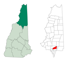
Thompson and Meserve's Purchase, New Hampshire | |
|---|---|
 A large portion of the Mount Washington Auto Road passes through the township. | |
 Location in Coös County, New Hampshire | |
| Coordinates: 44°18′1″N 71°17′23″W / 44.30028°N 71.28972°W | |
| Country | United States |
| State | New Hampshire |
| County | Coös |
| Area | |
• Total | 18.5 sq mi (48.0 km2) |
| • Land | 18.5 sq mi (48.0 km2) |
| • Water | 0.0 sq mi (0.0 km2) 0% |
| Elevation | 3,179 ft (969 m) |
| Population (2020)[2] | |
• Total | 1 |
| Time zone | UTC-5 (Eastern) |
| • Summer (DST) | UTC-4 (Eastern) |
| Area code | 603 |
| FIPS code | 33-007-76580 |
| GNIS feature ID | 872800 |
Thompson and Meserve's Purchase is a township in Coös County, New Hampshire, United States. The purchase lies entirely within the White Mountain National Forest. As of the 2020 census, the population of the purchase was one.[2]
In New Hampshire, locations, grants, townships (which are different from towns), and purchases are unincorporated portions of a county which are not part of any town and have limited self-government (if any, as many are uninhabited).
Thompson and Meserve's Purchase is notable for encompassing the northern slope of Mount Washington, including a large portion of the Mount Washington Auto Road and Cog Railway.
- ^ "2021 U.S. Gazetteer Files – New Hampshire". United States Census Bureau. Retrieved November 18, 2021.
- ^ a b "Thompson and Meserves purchase, Coos County, New Hampshire: 2020 DEC Redistricting Data (PL 94-171)". U.S. Census Bureau. Retrieved November 18, 2021.