Thornton, Colorado | |
|---|---|
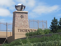
 Thornton welcome sign on Interstate 25 | |
 | |
Location of Thornton in the United States | |
| Coordinates: 39°54′11″N 104°57′16″W / 39.90306°N 104.95444°W | |
| Country | |
| State | |
| Counties[2] | Adams County Weld County |
| City[1] | Thornton |
| Incorporated | June 12, 1956[3] |
| Named for | Daniel I.J. Thornton |
| Government | |
| • Type | Home rule municipality[1] |
| • Mayor | Janifer "Jan" Kulmann (Since 2019) |
| • City Manager | Kevin Woods (Since 2017) |
| Area | |
• Total | 37.947 sq mi (98.282 km2) |
| • Land | 35.924 sq mi (93.043 km2) |
| • Water | 2.023 sq mi (5.239 km2) |
| Elevation | 5,351 ft (1,631 m) |
| Population | |
• Total | 141,867 |
| • Rank | 6th in Colorado 191st in the United States |
| • Density | 3,949/sq mi (1,525/km2) |
| • Metro | 2,963,821 (19th) |
| • CSA | 3,623,560 (17th) |
| • Front Range | 5,055,344 |
| Time zone | UTC−07:00 (MST) |
| • Summer (DST) | UTC−06:00 (MDT) |
| ZIP codes[6] | Denver 80221, 80229, 80233, 80241, 80260 Brighton 80602 |
| Area code(s) | Both 303 and 720 |
| FIPS code | 08-77290 |
| GNIS feature ID | 0181265 |
| Highways | |
| Website | City of Thornton |
Sixth most populous Colorado city | |
Thornton is a home rule municipality located in Adams and Weld counties, Colorado, United States.[1] The city population was 141,867, all in Adams County, at the 2020 United States Census, an increase of +19.44% since the 2010 United States Census.[4] Thornton is the sixth-most-populous city in Colorado and the 191st-most-populous city in the United States. Thornton is 10 miles (16 km) north of the Colorado State Capitol in Denver and is a part of the Denver–Aurora–Lakewood, CO Metropolitan Statistical Area.
- ^ a b c d "Active Colorado Municipalities". State of Colorado, Colorado Department of Local Affairs, Division of Local Government. Retrieved January 28, 2021.
- ^ "Colorado Counties". State of Colorado, Colorado Department of Local Affairs, Division of Local Government. Retrieved January 28, 2021.
- ^ "Colorado Municipal Incorporations". State of Colorado, Department of Personnel & Administration, Colorado State Archives. December 1, 2004. Retrieved September 2, 2007.
- ^ a b c "Decennial Census P.L. 94-171 Redistricting Data". United States Census Bureau, United States Department of Commerce. August 12, 2021. Retrieved September 4, 2021.
- ^ "US Board on Geographic Names". United States Geological Survey. October 25, 2007. Retrieved January 31, 2008.
- ^ "ZIP Code Lookup" (JavaScript/HTML). United States Postal Service. Retrieved January 6, 2008.


