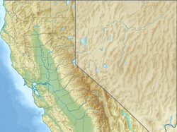
Three Rivers, California | |
|---|---|
 Location in Tulare County and the state of California | |
| Coordinates: 36°27′15″N 118°53′11″W / 36.45417°N 118.88639°W | |
| Country | |
| State | |
| County | Tulare |
| Area | |
| • Total | 44.505 sq mi (115.269 km2) |
| • Land | 44.505 sq mi (115.269 km2) |
| • Water | 0 sq mi (0 km2) 0% |
| Elevation | 843 ft (257 m) |
| Population | |
| • Total | 2,053 |
| • Density | 46/sq mi (18/km2) |
| Time zone | UTC−8 (Pacific) |
| • Summer (DST) | UTC−7 (PDT) |
| ZIP code | 93271 |
| Area code | 559 |
| FIPS code | 06-78638 |
| GNIS feature IDs | 1661569, 2409316 |
Three Rivers is an unincorporated community in Tulare County, California, United States. Located in the foothills of the Sierra Nevada at the edge of the San Joaquin Valley, the town is near the entrance to the national parks of Sequoia and Kings Canyon. The town's name comes from its location near the junction of the North, Middle, and South Forks of the Kaweah River.[4][5]
The population was 2,053 at the 2020 census, down from 2,182 at the 2010 census. For statistical purposes, the United States Census Bureau has defined Three Rivers as a census-designated place (CDP). The census definition of the area may not precisely correspond to local understanding of the area with the same name.
The two national parks, which border the town to the northeast, are the prime attraction of Three Rivers.
- ^ "2010 Census U.S. Gazetteer Files – Places – California". United States Census Bureau.
- ^ "Three Rivers". Geographic Names Information System. United States Geological Survey, United States Department of the Interior. Retrieved February 25, 2015.
- ^ "US Census Bureau". www.census.gov. Retrieved August 23, 2024.
- ^ Sahagun, Louis (December 23, 2016). "A black bear boom has a California town wondering how residents would get along with grizzlies". Los Angeles Times. Retrieved January 2, 2017.
- ^ Rocha, Veronica; Serna, Joseph (November 9, 2015). "Baby bear boom brings many of them to streets of Three Rivers, Calif". Los Angeles Times. Retrieved January 2, 2017.


