Thrissur district
Trichur district | |
|---|---|
|
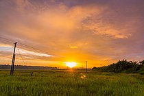
Clockwise from top: Thrissur Kole Wetlands, Cape of Kodungallur, Kerala Kalamandalam, Athirappilly Falls, Shakthan Thampuran Palace, Chimmini Wildlife Sanctuary | |
| Nickname: Cultural capital of Kerala | |
 Location in Kerala | |
| Coordinates: 10°31′N 76°13′E / 10.52°N 76.21°E | |
| Country | |
| State | Kerala |
| Headquarters | Thrissur |
| Government | |
| • District Collector & District Magistrate | Arjun Pandian IAS |
| • Police Commissioner (City) | R. Aadithya, IPS |
| • S.P (Rural) | Aishwarya Dongre, IPS |
| • Divisional Forest Officer, Thrissur | Kurra Srinivas IFS |
| Area | |
• Total | 3,032 km2 (1,171 sq mi) |
| • Rank | 4th |
| Population (2018)[1] | |
• Total | 3,243,170 |
| • Density | 1,070/km2 (2,800/sq mi) |
| Languages | |
| • Official | Malayalam, English |
| Time zone | UTC+5:30 (IST) |
| Vehicle registration | KL-08 Thrissur, KL-45 Irinjalakuda, KL-46 Guruvayur, KL-47 Kodungallur, KL-48 Wadakkancherry, KL-64 Chalakkudy, KL-75 Thriprayar |
| HDI (2005) | |
| Website | thrissur |
Thrissur (Malayalam: [t̪riʃ(ː)uːr] ), anglicised as Trichur, is one of the 14 districts in the Indian state of Kerala. It is situated in the central region of the state. Spanning an area of about 3,032 km2 (1,171 sq mi), the district is home to over 9% of Kerala's population.
Thrissur district is bordered by the districts of Palakkad and Malappuram to the north, the districts of Ernakulam and Idukki to the south and Coimbatore to the east. The Arabian Sea lies to the west and Western Ghats stretches towards the east. It is part of the historical Malabar Coast, which has been trading internationally since ancient times. The main language spoken is Malayalam.
Thrissur district was formed on 1 July 1949, with the headquarters at Thrissur City. Thrissur is known as the cultural capital of Kerala, and the land of Poorams. The district is known for its ancient temples, churches, and mosques. Thrissur Pooram is the most colourful temple festival in Kerala.
- ^ Annual Vital Statistics Report - 2018 (PDF). Thiruvananthapuram: Department of Economics and Statistics, Government of Kerala. 2020. p. 55.
- ^ "Kerala | UNDP in India". UNDP.


