| Thunder Creek | |
|---|---|
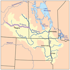
 The Red River drainage basin, with the Qu'Appelle River highlighted | |
| Location | |
| Country | |
| Provinces | |
| Physical characteristics | |
| Source | Man-made reservoir |
| • location | RM of Enfield No. 194 |
| • coordinates | 50°47′10″N 106°48′06″W / 50.7861°N 106.8017°W |
| Mouth | Moose Jaw River |
• location | City of Moose Jaw |
• coordinates | 50°23′14″N 105°31′46″W / 50.3871°N 105.5295°W |
• elevation | 557 m (1,827 ft) |
| Basin features | |
| River system | Qu'Appelle River |
| Tributaries | |
| • right | Sandy Creek |
Thunder Creek[1] is a river in the Canadian province of Saskatchewan. The watershed of Thunder Creek is within the semi-arid Palliser's Triangle in south-central Saskatchewan. It begins at small, man-made reservoir near Lake Diefenbaker and flows in a south-easterly direction towards the city of Moose Jaw and the Moose Jaw River. The Moose Jaw River is a major tributary of the Qu'Appelle River[2] For most of its course, Thunder Creek follows a valley called the Thunder Creek meltwater channel that was formed over 10,000 years ago near the end of the last ice age.[3]
During the drought of the 1980s, the river, and the marshes and lakes along its course, almost ran dry. To stabilise water levels, a reservoir was built at the head of the river. The reservoir is supplied by pumping in water from nearby Lake Diefenbaker.
- ^ "Thunder Creek". Canadian Geographical Names Database. Government of Canada. Retrieved 30 December 2022.
- ^ "Our Watershed". Moose Jaw River. Moose Jaw River Watershed Stewards. Retrieved 30 December 2022.
- ^ "Thunder Creek". Geoview.info. Geoview.info. Retrieved 30 December 2022.

