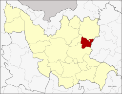
Thung Fon
ทุ่งฝน | |
|---|---|
 District location in Udon Thani province | |
| Coordinates: 17°28′18″N 103°15′36″E / 17.47167°N 103.26000°E | |
| Country | Thailand |
| Province | Udon Thani |
| Seat | Thung Fon |
| Area | |
• Total | 227.903 km2 (87.994 sq mi) |
| Population (2005) | |
• Total | 31,029 |
| • Density | 136.2/km2 (353/sq mi) |
| Time zone | UTC+7 (ICT) |
| Postal code | 41310 |
| Geocode | 4107 |
Thung Fon (Thai: ทุ่งฝน, pronounced [tʰûŋ fǒn]; Northeastern Thai: ท่งฝน, pronounced [tʰōŋ fǒn]) is a district (amphoe) in the eastern part of Udon Thani province, northeastern Thailand.