Ticuantepe | |
|---|---|
Municipality | |
 | |
| Coordinates: 12°1′N 86°12′W / 12.017°N 86.200°W | |
| Country | |
| Department | Managua |
| Area | |
| • Municipality | 23.5 sq mi (60.8 km2) |
| Population (2022 estimate)[1] | |
| • Municipality | 39,012 |
| • Density | 1,700/sq mi (640/km2) |
| • Urban | 18,070 |
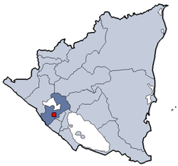
Ticuantepe is a town and a municipality in the Managua department of Nicaragua with an estimated population of 39,012. The municipality is likely named after the Nahua chiefdom of Tekwantepet which was located in the Managua department. According to Spanish conquistador and historian Gonzalo Fernández de Oviedo y Valdés, Tekwantepet was a small but militarily strong chiefdom that was one of the last to fall to the conquistadors and their central Mexican allies.[2][3][4] The chiefdom's name is a combination of the Nawat words tēkwani (jaguar),[5] and tepet (hill),[6] therefore the translation of Tekwantepet is "hill of jaguars" or "jaguar hill".
- ^ Citypopulation.de Population of Ticuantepe municipality
- ^ Vida de González Dávila, Gil. Ávila, c. 1480 – 21.IV.1526. Descubridor y conquistador. et al., 2012
- ^ Historia general y natural de las Indias, islas y tierra-firme del mar océano; por el Capitán Gonzalo Fernández de Oviedo y Valdés; Primer Cronista del Nuevo Mundo; publícala la Real Academia de la Historia.- Tomo IV.- Libro XLII.- Capitulo XIII.
- ^ Colonización de américa, cuando la historia marcha, de Oviedo y Valdés, Gonzalo c. 1480 - 1557, 2006
- ^ Campbell, Lyle (January 1, 1985). The Pipil Language of El Salvador. Walter de Gruyter. pp. 10–12. ISBN 978-3-11-088199-8.
- ^ "El Nawat de Cuzcatlan".
