This article needs additional citations for verification. (May 2022) |
Tielen | |
|---|---|
Village | |
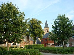
 View on the village centre | |
| Coordinates: 51°14′N 4°53′E / 51.233°N 4.883°E | |
| Country | |
| Region | Flemish Region |
| Province | Antwerp |
| Municipality | Kasterlee |
| Area | |
| • Total | 14.42 km2 (5.57 sq mi) |
| Population (2021)[1] | |
| • Total | 4,060 |
| • Density | 280/km2 (730/sq mi) |
| Time zone | CET |
Tielen is a village in the province of Antwerp in Flanders, Belgium. It is part of the municipality of Kasterlee. The nearest city is the neighbouring city of Turnhout. Other neighbouring towns are Vosselaar, Lichtaart, Poederlee, Lille and Gierle.
The borders of Tielen are marked by two rivers: The Aa and the Kaliebeek. Almost one third of the village is still covered with pine-woods, heath and swamps. Typical for the Kempen area.
The rest of this 1,371-hectare (5.29 sq mi) village is mostly used for residential and agricultural purposes.
- ^ a b "Bevolking per statistische sector - Sector 13017C". Statistics Belgium. Retrieved 9 May 2022.
