Tifariti
تيفاريتي | |
|---|---|
 Tifariti, 2005 | |
| Coordinates: 26°9′29″N 10°34′1″W / 26.15806°N 10.56694°W | |
| Territory | Western Sahara |
| Claimed by | |
| Controlled by | |
| Government | |
| • Type | Municipality[1] |
| • Mayor | Mohammed Salem Dayah[2] |
| Area | |
| • Total | 6.78 km2 (2.62 sq mi) |
| Elevation | 490 m (1,610 ft) |
| Population (2010) | |
| • Total | 3,000 |
| • Density | 440/km2 (1,100/sq mi) |
| Climate | BWh |
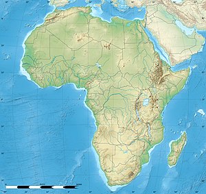
Tifariti (Arabic: تيفاريتي) is an oasis town and the temporary capital of the Sahrawi Arab Democratic Republic,[3] located in north-eastern Western Sahara, east of the Moroccan Berm, 138 km (86 mi) from Smara and 15 km (9 mi) north of the border with Mauritania. It is part of what Polisario Front calls the Liberated Territories and Morocco call the Buffer Zone. It has been the de facto temporary capital of the Sahrawi Arab Democratic Republic since the government moved there in 2008 from Bir Lehlou. It is the headquarters of the 2nd military region of the SADR.
It is also the name of a Daïra of the Wilaya of Smara, in the Sahrawi refugee camps.
In 2010, the population of Tifariti was estimated at around 3,000 people.[citation needed]
Tifariti is located between Smara, the traditional spiritual centre of the Sahara founded by Ma El Ainin (177 km (110 mi) away)[4] and the Algerian town of Tindouf (320 km (200 mi) away), where the Sahrawi refugee camps are located.
The government quarter of Tifariti houses the Parliament of the SADR, a hospital, a school, a mosque and a museum.[citation needed]
- ^ "Allocating seats for the liberated territories in Parliament will be considered in the next election (Official)". Sahara Press Service. 2012-02-20. Archived from the original on 2014-09-12. Retrieved 2012-02-07.
- ^ "Minister of Defense receives Ross in liberated Tifariti". Sahara Press Service. 2012-03-11. Archived from the original on 2014-12-22. Retrieved 2012-03-11.
- ^ "Sahara Occidental – Actualités 2008, février". February 2008. Archived from the original on 16 January 2017. Retrieved 17 September 2016.
- ^ "La Mili en el Sáhara - Asociación Nacional Veteranos Mili Sáhara". www.sahara-mili.net. Archived from the original on 27 February 2012. Retrieved 18 April 2018.


