This article needs additional citations for verification. (September 2007) |
Tillamook County | |
|---|---|
 Tillamook County Courthouse in Tillamook | |
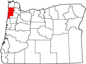
 Location within the U.S. state of Oregon | |
 Oregon's location within the U.S. | |
| Coordinates: 45°28′N 123°42′W / 45.46°N 123.7°W | |
| Country | |
| State | |
| Founded | December 15, 1853 |
| Named for | Tillamook people |
| Seat | Tillamook |
| Largest city | Tillamook |
| Area | |
• Total | 1,333 sq mi (3,450 km2) |
| • Land | 1,103 sq mi (2,860 km2) |
| • Water | 230 sq mi (600 km2) 17% |
| Population (2020) | |
• Total | 27,390 |
• Estimate (2023) | 27,417 |
| • Density | 23/sq mi (9/km2) |
| Congressional district | 1st |
| Website | www |
Tillamook County is one of the 36 counties in the U.S. state of Oregon. As of the 2020 census, the population was 27,390.[1] The county seat is Tillamook.[2] The county is named for the Tillamook or Killamook people, a Native American tribe who were living in the area in the early 19th century at the time of European American settlement. The county is located within Northwest Oregon.
- ^ "State & County QuickFacts". United States Census Bureau. Retrieved May 17, 2023.
- ^ "Find a County". National Association of Counties. Retrieved June 7, 2011.