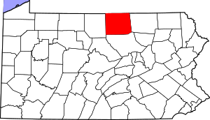
Tioga County | |
|---|---|
 Tioga County Courthouse | |
 Location within the U.S. state of Pennsylvania | |
 Pennsylvania's location within the U.S. | |
| Coordinates: 41°46′N 77°15′W / 41.77°N 77.25°W | |
| Country | |
| State | |
| Founded | October 13, 1812 |
| Named for | Tioga River |
| Seat | Wellsboro |
| Largest borough | Mansfield |
| Area | |
• Total | 1,137 sq mi (2,940 km2) |
| • Land | 1,134 sq mi (2,940 km2) |
| • Water | 3.2 sq mi (8 km2) 0.3% |
| Population (2020) | |
• Total | 41,045 |
| • Density | 36/sq mi (14/km2) |
| Time zone | UTC−5 (Eastern) |
| • Summer (DST) | UTC−4 (EDT) |
| Congressional district | 15th |
| Website | www |
Tioga County is a county in the Commonwealth of Pennsylvania. As of the 2020 census, the population was 41,045.[1] Its county seat is Wellsboro.[2] The county was created on March 26, 1804, from part of Lycoming County[3] and later organized in 1812.[4] It is named for the Tioga River. The county is part of the North Central Pennsylvania region of the state.[a]
- ^ "Census - Geography Profile: Tioga County, Pennsylvania". United States Census Bureau. Retrieved December 18, 2022.
- ^ "Find a County". National Association of Counties. Retrieved June 7, 2011.
- ^ An outline history of Tioga and Bradford counties in Pennsylvania, Chemung, Steuben, Tioga, Tompkins and Schuyler in New York: by townships, villages, boro's and cities, John L. Sexton. The Gazette Company, 1885, p3. 1885. p. 3. Retrieved September 17, 2010.
tioga county, pa. sexton.
- ^ "Pennsylvania: Individual County Chronologies". Pennsylvania Atlas of Historical County Boundaries. The Newberry Library. 2008. Archived from the original on March 25, 2015. Retrieved March 13, 2015.
Cite error: There are <ref group=lower-alpha> tags or {{efn}} templates on this page, but the references will not show without a {{reflist|group=lower-alpha}} template or {{notelist}} template (see the help page).