| Titteri | |
|---|---|
| Tittri / جبل التيطري | |
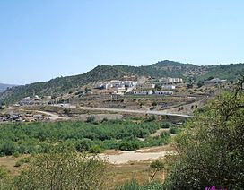
 Landscape of the Mezghena commune in the Titteri, Médéa Province | |
| Highest point | |
| Peak | Djebel Dirrah |
| Elevation | 1,485 m (4,872 ft) |
| Coordinates | 36°16′0″N 2°45′0″E / 36.26667°N 2.75000°E[1] |
| Geography | |
| Parent range | Blidean Atlas |
The Titteri (Arabic: جبل التيطري, Berber languages: Tittri) is a historical region in Algeria.[2] It is located in the mountainous area of the southern Tell Atlas in the Atlas Mountains.
