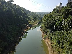
| Tlawng River | |
|---|---|
 | |
 | |
| Location | |
| Country | India |
| State | Mizoram, Assam |
| Cities | Aizawl, Lunglei |
| Physical characteristics | |
| Source | |
| • elevation | 1,398 m (4,587 ft) |
| Mouth | |
• location | Zopui Hill |
| Length | 185.5 km (115.3 mi) |
| Basin features | |
| Tributaries | |
| • left | Tut |
| • right | Teirei |
The Tlawng is a river of Mizoram, northeastern India.[1] Its tributaries include the Tut, Teirei and the Ngashih. The city of Aizawl is situated to the east of the Tlawng river.
In 2012, a dam (Tlawng Dam) was proposed for the river.
- ^ Pachuau, Rintluanga (1 January 2009). Mizoram: A Study in Comprehensive Geography. Northern Book Centre. p. 35. ISBN 978-81-7211-264-6. Retrieved 8 August 2012.