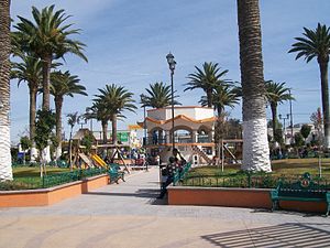
Tlaxcoapan | |
|---|---|
Municipality and town | |
 | |
| Coordinates: 20°05′43″N 99°13′12″W / 20.09528°N 99.22000°W | |
| Country | |
| State | Hidalgo |
| Municipal seat | Tlaxcoapan |
| Area | |
| • Municipality and town | 79.3 km2 (30.6 sq mi) |
| Population (2010 census) | |
| • Municipality and town | 26,758 |
| • Density | 340/km2 (870/sq mi) |
| • Metro | Tula de Allende |
Tlaxcoapan is a town and one of the 84 municipalities of Hidalgo, in central-eastern Mexico. The municipality covers an area of 79.3 km².[1]
[2]As of 2005, the municipality had a total population of 26,758.[3] It is now part of Tula de Allende built-up (or metro) area.
- ^ "Tlaxcoapan, Hidalgo (Mehiko) Postal Code Listahan - Cybo". postal-code.cybo.com (in Tagalog). Retrieved 2024-10-06.
- ^ "Today Matsuo Bashō Cooks", Today Matsuo Bashō Cooks, The Chinese University of Hong Kong Press, pp. 15–17, 2020-03-15, retrieved 2024-10-06
- ^ "Tlaxcoapan". Enciclopedia de los Municipios de México. Instituto Nacional para el Federalismo y el Desarrollo Municipal. Retrieved December 27, 2008.

