This article includes a list of general references, but it lacks sufficient corresponding inline citations. (April 2015) |
Toa Payoh | |
|---|---|
| Other transcription(s) | |
| • Chinese | 大巴窑 (Simplified) 大巴窯 (Traditional) Dàbāyáo (Pinyin) Tōa Pa-iô (Hokkien POJ) |
| • Malay | Toa Payoh |
| • Tamil | தோ பாயோ Tō pāyō (Transliteration) |
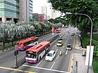
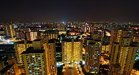
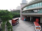
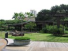
From top left to right: Toa Payoh Town Centre; Lorong 6 Toa Payoh; Toa Payoh MRT station; Toa Payoh at night with Bishan and Serangoon in the distance; Toa Payoh Bus Interchange; Toa Payoh Town Park | |
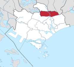 Location in Central Region | |
| Coordinates: 1°20′03″N 103°51′23″E / 1.3343°N 103.8563°E | |
| Country | |
| Region | Central Region
|
| CDC | |
| Town councils |
|
| Constituencies | |
| Government | |
| • Mayor | Central Singapore CDC
|
| • Members of Parliament | Bishan-Toa Payoh GRC
Potong Pasir SMC |
| Area | |
• Total | 8.17 km2 (3.15 sq mi) |
| • Residential | 2.48 km2 (0.96 sq mi) |
| Elevation | 7.94 m (26.05 ft) |
| Population | |
• Total | 120,650 |
| • Density | 15,000/km2 (38,000/sq mi) |
| Demonym | Official
|
| Postal districts | 11, 12, 13 |
| Dwelling units | 36,439 |
| Projected ultimate | 61,000 |
Toa Payoh (/ˌtɔː ˈpɑːjoʊ/ taw PAH-yoh, simplified Chinese: 大巴窑; traditional Chinese: 大巴窯, Tamil: தோ பாயோ) is a planning area and mature residential town located in the northern part of the Central Region of Singapore.[4][5] Toa Payoh planning area borders Bishan and Serangoon to the north, the Central Water Catchment to the northwest, Kallang to the south, Geylang to the southeast, Novena to the west and Hougang to the east. Toa Payoh New Town is situated in the western portion of the Toa Payoh planning area. The latter occupies a much larger area, encompassing estates such as Potong Pasir and Bidadari.
- ^ a b "City Population - statistics, maps and charts |Toh Payoh". Archived from the original on 11 April 2020. Retrieved 23 October 2015.
- ^ a b HDB Key Statistics FY 2014/2015 Archived 4 March 2016 at the Wayback Machine
- ^ "Statistics Singapore - Geographic Distribution - 2018 Latest Data". Retrieved 11 February 2019.
- ^ "Map of Planning Areas/Subzones in Singapore" (PDF). Singapore Department of Statistics. Archived from the original (PDF) on 5 March 2016. Retrieved 20 February 2016.
- ^ "Singapore Infopedia |Toa Payoh New Town". Archived from the original on 19 September 2015. Retrieved 23 October 2015.

