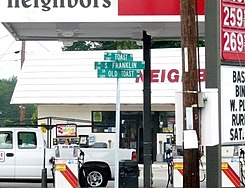
Toast, North Carolina | |
|---|---|
Census-designated place (CDP) | |
 Downtown Toast, North Carolina | |
 Location of Toast, North Carolina | |
| Coordinates: 36°29′48″N 80°38′05″W / 36.49667°N 80.63472°W | |
| Country | United States |
| State | North Carolina |
| County | Surry |
| Government | |
| • Mayor | Carl Ray Shelton |
| Area | |
| • Total | 1.52 sq mi (3.94 km2) |
| • Land | 1.51 sq mi (3.91 km2) |
| • Water | 0.01 sq mi (0.03 km2) |
| Elevation | 1,112 ft (339 m) |
| Population (2020) | |
| • Total | 1,423 |
| • Density | 943.01/sq mi (364.17/km2) |
| Time zone | UTC-5 (Eastern (EST)) |
| • Summer (DST) | UTC-4 (EDT) |
| ZIP code | 27049 |
| Area code | 336 |
| FIPS code | 37-67700[3] |
| GNIS feature ID | 2402936[2] |
Toast is a census-designated place (CDP) in Surry County, North Carolina, United States, just west of Mount Airy. The population was 1,922 at the 2000 census.
A post office called Toast has been in operation since 1929.[4] The name "Toast" was supplied by the Post Office Department.[5] E. P. McLeod, the school principal, supposedly came up with the name while buying groceries at Hutchens Store one evening in 1927.[6]
- ^ "ArcGIS REST Services Directory". United States Census Bureau. Retrieved September 20, 2022.
- ^ a b U.S. Geological Survey Geographic Names Information System: Toast, North Carolina
- ^ "U.S. Census website". United States Census Bureau. Retrieved January 31, 2008.
- ^ "Post Offices". Jim Forte Postal History. Retrieved January 5, 2017.
- ^ Moyer, Armond; Moyer, Winifred (1958). The origins of unusual place-names. Keystone Pub. Associates. p. 133.
- ^ Gallant, Frank K. (1998). A Place Called Peculiar: Stories About Unusual Place Names, Merriam Webster, p. 178