| Tobacco Root Mountains | |
|---|---|
 Panoramic view of Tobacco Roots | |
| Highest point | |
| Peak | Hollowtop Peak |
| Elevation | 10,604 ft (3,232 m) |
| Geography | |
| Country | United States |
| State | Montana |
| Range coordinates | 45°33.3′N 111°58.5′W / 45.5550°N 111.9750°W |
| Parent range | Rocky Mountains |
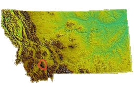
The Tobacco Root Mountains lie in the northern Rocky Mountains, between the Jefferson and Madison Rivers in southwest Montana.[1] The highest peak is Hollowtop at 10,604 feet (3,232 m). The range contains 43 peaks rising to elevations greater than 10,000 feet (3048 m).
Much of the central part of the range is within the Beaverhead-Deerlodge National Forest, although many—mostly small—patented mining claims exist within the forest boundary. The range saw significant gold mining, especially during the 1880s to 1930s.
The high peaks have been extensively glaciated, and most of the larger stream valleys held valley glaciers during the ice age.
