| Tombigbee River | |
|---|---|
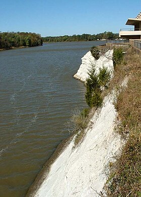
 Tombigbee River at White Bluff (Ecor Blanc) in Demopolis | |
 Tombigbee and Alabama river basins | |
| Location | |
| Country | United States |
| State | Alabama and Mississippi |
| Physical characteristics | |
| Source | |
| • location | Confluence of Tennessee-Tombigbee Waterway and Black Warrior River |
| Mouth | |
• location | Mobile River, at Mobile, Alabama |
| Length | 200 miles (320 km) |
The Tombigbee River is a tributary of the Mobile River, approximately 200 mi (325 km) long, in the U.S. states of Mississippi and Alabama. Together with the Alabama, it merges to form the short Mobile River before the latter empties into Mobile Bay on the Gulf of Mexico. The Tombigbee watershed encompasses much of the rural coastal plain of western Alabama and northeastern Mississippi, flowing generally southward. The river provides one of the principal routes of commercial navigation in the southern United States, as it is navigable along much of its length through locks and connected in its upper reaches to the Tennessee River via the Tennessee-Tombigbee Waterway.
The name "Tombigbee" comes from Choctaw /itumbi ikbi/, meaning "box maker, coffin maker", from /itumbi/, "box, coffin", and /ikbi/, "maker".[1] The river formed the eastern boundary of the historical Choctaw lands, from the 17th century when they coalesced as a people, to the forced Indian Removal by the United States in the 1830s.[2]
- ^ Bright, William (2004). Native American placenames of the United States. University of Oklahoma Press. p. 504. ISBN 978-0-8061-3598-4. Retrieved 11 April 2011.
- ^ Patricia Galloway, Choctaw Genesis, 1500-1700, University of Nebraska Press, 1998