Tonganoxie, Kansas | |
|---|---|
 Downtown Tonganoxie (2024) | |
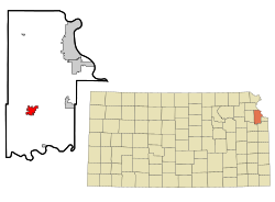
 Location within Leavenworth County and Kansas | |
 | |
| Coordinates: 39°06′32″N 95°04′51″W / 39.10889°N 95.08083°W[1] | |
| Country | United States |
| State | Kansas |
| County | Leavenworth |
| Platted | 1866 |
| Incorporated | 1871 |
| Government | |
| • Type | Council–manager |
| • Mayor | David Frese |
| • City Manager | George Brajkovic |
| Area | |
• Total | 4.09 sq mi (10.60 km2) |
| • Land | 4.05 sq mi (10.50 km2) |
| • Water | 0.04 sq mi (0.10 km2) |
| Elevation | 850 ft (260 m) |
| Population | |
• Total | 5,573 |
| • Density | 1,400/sq mi (530/km2) |
| Time zone | UTC-6 (CST) |
| • Summer (DST) | UTC-5 (CDT) |
| ZIP code | 66086 |
| Area code | 913 |
| GNIS ID | 2397035[1] |
| Website | tonganoxie.org |
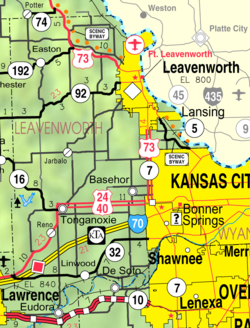
Tonganoxie (pronounced /tɒŋɡəˈnɒksi/)[5] is a city in Leavenworth County, Kansas, United States[1] and is part of the Kansas City metropolitan area.[6] As of the 2020 census, the population of the city was 5,573.[3][4]
- ^ a b c d U.S. Geological Survey Geographic Names Information System: Tonganoxie, Kansas
- ^ "2019 U.S. Gazetteer Files". United States Census Bureau. Retrieved July 24, 2020.
- ^ a b "Profile of Tonganoxie, Kansas in 2020". United States Census Bureau. Archived from the original on November 19, 2022. Retrieved November 19, 2022.
- ^ a b "QuickFacts; Tonganoxie, Kansas; Population, Census, 2020 & 2010". United States Census Bureau. Archived from the original on August 28, 2021. Retrieved August 28, 2021.
- ^ William Allen White School of Journalism and Public Information (1955). A pronunciation guide to Kansas place names. Lawrence, KS: University of Kansas. p. 25. hdl:2027/mdp.39015047651115.
- ^ "City Population".