Torrelodones | |
|---|---|
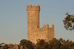
 Watchtower of Torrelodones, gives the name to the municipality | |
| Nickname: Torre | |
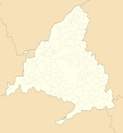
 Location in the Community of Madrid, Spain | |
| Coordinates (Town Hall): 40°34′32″N 3°55′45″W / 40.57556°N 3.92917°W | |
| Country | Spain |
| Autonomous community | Community of Madrid |
| Province | Madrid |
| Comarcas | Madrid metropolitan area Comarca agrícola de Guadarrama |
| Administrative Divisions | 3 |
| Founded | c. VII century |
| Population nuclei | Pueblo, Colonia, Los Peñascales |
| Government | |
| • Alcaldesa | Almudena Negro (PP) |
| Area | |
• Total | 21.95 km2 (8.47 sq mi) |
| Elevation | 845 m (2,772 ft) |
| Highest elevation | 1,011 m (3,317 ft) |
| Lowest elevation | 675 m (2,215 ft) |
| Population (2021)[1] | |
• Total | 24,122 |
| • Density | 1,053.67/km2 (2,729.0/sq mi) |
| Time zone | UTC+01:00 (CET) |
| • Summer (DST) | UTC+02:00 (CEST) |
| Postal code | 28250 |
| Area codes | +34 (Spain) + 91 (Madrid) |
| Website | torrelodones |
Torrelodones is a municipality in the northwest of the Autonomous Community of Madrid, Spain. It is situated 29 kilometers northwest from the city of Madrid. Because of its location between the Sierra de Guadarrama and the metropolitan area of the capital, it is linked to two districts in Madrid: the agricultural area of Guadarrama and the metropolitan area of Madrid.
It lies at an average altitude of 845 meters. According to the 2022 census, 24,775 people live in the municipality, distributed among seven towns.[2]
The people of Torrelodones earn among the highest per capita incomes of the Community of Madrid. Services, hotels, and construction are the main economic activities. In 2012 it had about 22,680 inhabitants. With over three colleges and four developments, Torrelodones is usually divided into two parts: the "Torrelodones town", where there is the Town Hall, and the "Torrelodones colony", where there are schools, homes and small businesses.
The town has an interesting artistic and natural heritage and is part of two tourist routes in the Community of Madrid. One of them is the Imperial Route, which partially follows the historic route used in the 16th century by King Philip II in his travels from the city of Madrid to the Royal Site of El Escorial.[3] The other is the Route through the Castles, Fortresses and Watchtowers, to which it is linked by the Watchtower of Torrelodones.
Torrelodones is bordered to the north by Hoyo de Manzanares, to the south by Las Rozas de Madrid, to the west by Galapagar, and to the east by Madrid (through El Monte de El Pardo).
Historically the municipality was named "Torrelodones" (Lodones' Tower). That name led to the current name of the town Torrelodones. The name comes from, for one side, the Muslim watchtower that Muslims used during Al-andalus age to guard the city from the attacks of Christian people during the Iberian peninsula's reconquest. For the other side, "Lodon" (hack berry) is a type of tree that was really abundant in that zone whose scientific name is Celtis australis.
- ^ Municipal Register of Spain 2018. National Statistics Institute.
- ^ "Madrid: Población por municipios y sexo. (2881)". INE (in Spanish). Retrieved 2023-10-11.
- ^ "Descripción de la Ruta Imperial de la Comunidad de Madrid, de carácter turístico" (PDF) (in Spanish). tauricio.com. Archived from the original (PDF) on 30 May 2009. Retrieved 10 May 2009.


