Torsken Municipality
Torsken kommune | |
|---|---|
 View of Medby in Torsken | |
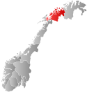
 Troms within Norway | |
 Torsken within Troms | |
| Coordinates: 69°17′47″N 17°02′11″E / 69.29639°N 17.03639°E | |
| Country | Norway |
| County | Troms |
| District | Midt-Troms |
| Established | 1 Jan 1902 |
| • Preceded by | Berg Municipality |
| Disestablished | 1 Jan 2020 |
| • Succeeded by | Senja Municipality |
| Administrative centre | Gryllefjord |
| Government | |
| • Mayor (2007–2019) | Fred Flakstad (Ap) |
| Area (upon dissolution) | |
| • Total | 243.42 km2 (93.98 sq mi) |
| • Land | 235.30 km2 (90.85 sq mi) |
| • Water | 8.12 km2 (3.14 sq mi) 3.3% |
| • Rank | #310 in Norway |
| Highest elevation | 963.4 m (3,160.8 ft) |
| Population (2019) | |
| • Total | 931 |
| • Rank | #403 in Norway |
| • Density | 3.8/km2 (10/sq mi) |
| • Change (10 years) | |
| Demonym | Torskeværing[2] |
| Official language | |
| • Norwegian form | Bokmål |
| Time zone | UTC+01:00 (CET) |
| • Summer (DST) | UTC+02:00 (CEST) |
| ISO 3166 code | NO-1928[4] |
Torsken (Northern Sami: Doaskku suohkan) is a former municipality that was located on the western coast of the large island of Senja in Troms county, Norway. The municipality existed from 1902 until its dissolution in 2020 when it was merged into the new Senja Municipality. The administrative centre of the municipality was the village of Gryllefjord. Other larger villages in Torsken Municipality included the villages of Torsken, Medby, and Flakstadvåg.
Prior to its dissolution in 2020, the 243-square-kilometre (94 sq mi) municipality was the 310th largest by area out of the 422 municipalities in Norway. Torsken was also the 403rd most populous municipality in Norway with a population of 931. The municipality's population density was 3.8 inhabitants per square kilometre (9.8/sq mi) and its population has increased by 1.6% over the previous decade.[5][6]
The historic Torsken Church in the village of Torsken dates back to the 18th century. Ånderdalen National Park was partially located inside the old borders of both Torsken Municipality and neighboring Tranøy Municipality.
- ^ "Høgaste fjelltopp i kvar kommune" (in Norwegian). Kartverket. 16 January 2024. Archived from the original on 12 March 2019.
- ^ "Navn på steder og personer: Innbyggjarnamn" (in Norwegian). Språkrådet.
- ^ "Forskrift om målvedtak i kommunar og fylkeskommunar" (in Norwegian). Lovdata.no.
- ^ Bolstad, Erik; Thorsnæs, Geir, eds. (26 January 2023). "Kommunenummer". Store norske leksikon (in Norwegian). Kunnskapsforlaget.
- ^ Statistisk sentralbyrå (2018). "Table: 06913: Population 1 January and population changes during the calendar year (M)" (in Norwegian). Retrieved 10 December 2018.
- ^ Statistisk sentralbyrå. "09280: Area of land and fresh water (km²) (M)" (in Norwegian). Retrieved 10 December 2018.

