| Toter Mann | |
|---|---|
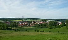
 View from Petersberg over the houses of Sorga in the Solz valley looking NE to the Toter Mann, the highest hill in the Seulingswald | |
| Highest point | |
| Elevation | 480.3 m above sea level (NHN) (1,576 ft) |
| Coordinates | 50°54′1″N 9°50′20.1″E / 50.90028°N 9.838917°E |
| Geography | |
| Parent range | Seulingswald |
| Geology | |
| Mountain type | ridge |
| Rock type | Sandstone |

The Toter Mann near Friedewald in the Hessian county of Hersfeld-Rotenburg is, at 480.3 m above sea level (NHN),[1] the highest natural[2] hill in the Seulingswald range. This small upland is the southernmost spur of the Fulda-Werra Uplands.
- ^ Map services of the Federal Agency for Nature Conservation
- ^ Cite error: The named reference
ToMannMoKaliwas invoked but never defined (see the help page).
