Towns County | |
|---|---|
 Towns County Courthouse in Hiawassee | |
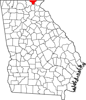
 Location within the U.S. state of Georgia | |
 Georgia's location within the U.S. | |
| Coordinates: 34°55′N 83°44′W / 34.92°N 83.74°W | |
| Country | |
| State | |
| Founded | 1856 |
| Named for | George W. Towns |
| Seat | Hiawassee |
| Largest city | Young Harris |
| Area | |
• Total | 172 sq mi (450 km2) |
| • Land | 167 sq mi (430 km2) |
| • Water | 5.4 sq mi (14 km2) 3.2% |
| Population (2020) | |
• Total | 12,493 |
| • Density | 75/sq mi (29/km2) |
| Time zone | UTC−5 (Eastern) |
| • Summer (DST) | UTC−4 (EDT) |
| Congressional district | 9th |
| Website | www |
Towns County is a county in the Northeast region of the U.S. state of Georgia. As of the 2020 census, the population was 12,493.[1] Its county seat is Hiawassee.[2] The county was created on March 6, 1856, and named for lawyer, legislator, and politician George W. Towns.[3]
- ^ "Census - Geography Profile: Towns County, Georgia". United States Census Bureau. Retrieved December 29, 2022.
- ^ "Find a County". National Association of Counties. Retrieved June 7, 2011.
- ^ Krakow, Kenneth K. (1975). Georgia Place-Names: Their History and Origins (PDF). Macon, GA: Winship Press. p. 230. ISBN 0-915430-00-2. Archived (PDF) from the original on September 17, 2003.