Toyokawa
豊川市 | |
|---|---|
 Interactive map outlining Toyokawa | |
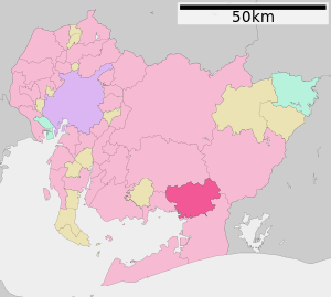
 Location of Toyokawa in Aichi Prefecture | |
| Coordinates: 34°49′36.4″N 137°22′33.3″E / 34.826778°N 137.375917°E | |
| Country | Japan |
| Region | Chūbu (Tōkai) |
| Prefecture | Aichi |
| First official recorded | 480 AD |
| City Settled | June 1, 1943 |
| Government | |
| • Mayor | Minoru Yamawaki |
| Area | |
• Total | 161.14 km2 (62.22 sq mi) |
| Population (October 1, 2019) | |
• Total | 183,930 |
| • Density | 1,100/km2 (3,000/sq mi) |
| Time zone | UTC+9 (Japan Standard Time) |
| – Tree | Japanese Black Pine |
| – Flower | Dwarf azalea |
| Phone number | 0533-89-2111 |
| Address | 1-1 Suwa-chō, Toyokawa-shi, Aichi-ken 442-0068 |
| Website | Official website |
Toyokawa (豊川市, Toyokawa-shi) is a city in the eastern part of Aichi Prefecture, Japan. As of 1 October 2019[update], the city had an estimated population of 183,930 in 72,949 households,[1] and a population density of 1,141 persons per km2. The total area of the city is 161.14 square kilometres (62.22 sq mi). Toyokawa, famous for its Toyokawa Inari temple, has a good balance of industry, commerce, agriculture and forestry, and is situated in an area rich in history, traditions, and culture.
- ^ Toyokawa City official statistics (in Japanese)


