This article needs additional citations for verification. (April 2007) |
Travnik
Травник | |
|---|---|
Town and municipality | |
 Travnik | |
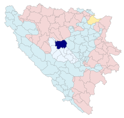
 Location of Travnik Municipality within Bosnia and Herzegovina. | |
| Coordinates: 44°13′35″N 17°39′35″E / 44.22639°N 17.65972°E | |
| Country | |
| Entity | Federation of Bosnia and Herzegovina |
| Canton | |
| Government | |
| • Municipal mayor | Kenan Dautović (SDA) |
| Area | |
• Town and municipality | 529 km2 (204 sq mi) |
| Elevation | 514 m (1,686 ft) |
| Population (2013 census) | |
| • Density | 101.10/km2 (261.8/sq mi) |
| • Urban | 15,344 |
| • Municipality | 53,482 |
| Time zone | UTC+1 (CET) |
| • Summer (DST) | UTC+2 (CEST) |
| Postal code | 72270 |
| Area code | +387 30 |
| Website | www |
Preview warning: Page using Template:Infobox settlement with unknown parameter "image_shield_caption"
Travnik (Cyrillic: Травник) is a town and a municipality in Bosnia and Herzegovina. It is the administrative center of the Central Bosnia Canton of the Federation of Bosnia and Herzegovina. It is situated in central Bosnia and Herzegovina, 90 kilometres (56 miles) west of Sarajevo. As of 2013,[update] the town had a population of 15,344 inhabitants, while the municipality had 53,482 inhabitants.
Historically, it was the capital city of the governors of Bosnia from 1699 to 1850, and has a cultural heritage dating from that period.[1]
- ^ "OVGuide | Online Video Guide". Archived from the original on 4 March 2016. Retrieved 24 January 2013.

