Treasure Island
Magic Isle[1] | |
|---|---|
Landform and neighborhood | |
![Treasure Island is "5,520 feet long by 3,410 feet wide"[1] and has the Treasure Island Marina on the south near Yerba Buena Island (bottom)](http://upload.wikimedia.org/wikipedia/commons/thumb/b/b8/Wfm_yerba_buena_treasure_islands_usgs.jpg/200px-Wfm_yerba_buena_treasure_islands_usgs.jpg) Treasure Island is "5,520 feet long by 3,410 feet wide"[1] and has the Treasure Island Marina on the south near Yerba Buena Island (bottom) | |
 Treasure Island is the northernmost area of San Francisco's District 6 | |
| Coordinates: 37°49′30″N 122°22′16″W / 37.825°N 122.371°W | |
| Country | |
| State | |
| City-county | San Francisco |
| Constructed | 1936–37 |
| Named for | Treasure Island (novel) |
| Government | |
| • Supervisor | Matt Dorsey (Dist. 6) |
| • Assemblymember | Matt Haney (D)[2] |
| • State senator | Scott Wiener (D)[2] |
| • U. S. rep. | Nancy Pelosi (D)[3] |
| Area | |
• Total | 0.9 sq mi (2 km2) |
| • Land | 0.9 sq mi (2 km2) |
| • Water | 0 sq mi (0 km2) 0% |
| Population (2024 estimate)[4] | |
• Total | 2,800 |
| • Density | 3,100/sq mi (1,200/km2) |
| Time zone | UTC-8 (Pacific) |
| • Summer (DST) | UTC-7 (PDT) |
| ZIP code | 94130 |
| Area codes | 415/628 |
| GNIS feature IDs[5] | 236528 (island) 2624152 (Building 157) 2506912 (Job Corps Ctr) |
| Wikimedia Commons | Treasure Island, California |
| Website | Treasure Island Development Authority |
| Reference no. | 987[6] |
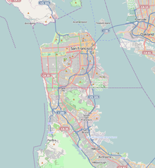
Treasure Island is an artificial island in San Francisco Bay, and a neighborhood in the City and County of San Francisco. Built in 1936–37 for the 1939 Golden Gate International Exposition, the island was named by Clyde Milner Vandeburg, part of the Fair's public relations team.[7]: 8 Its World's Fair site is a California Historical Landmark.[6] Buildings there have been listed on the National Register of Historic Places, and the historical Naval Station Treasure Island, an auxiliary air facility (for airships, blimps, dirigibles, planes and seaplanes), are designated in the Geographic Names Information System.[5] Treasure Island is connected to Yerba Buena Island, another (natural) auxiliary island of San Francisco, by a causeway, creating access to Interstate 80.
- ^ a b Cite error: The named reference
McGloinwas invoked but never defined (see the help page). - ^ a b "Statewide Database". UC Regents. Retrieved November 5, 2014.
- ^ "California's 11th Congressional District - Representatives & District Map". Civic Impulse, LLC.
- ^ a b Cite error: The named reference
datawas invoked but never defined (see the help page). - ^ a b Cite error: The named reference
gniswas invoked but never defined (see the help page). - ^ a b Office of Historic Preservation. "San Francisco". California Historical Landmarks. California Department of Parks and Recreation. Retrieved October 26, 2013.
- ^ Cotter, Bill (2021). San Francisco's 1939-1940 World's Fair: The Golden Gate International Exposition. Charleston, South Carolina: Images of America, Arcadia Publishing. ISBN 9781467106160.
