| Triglav | |
|---|---|
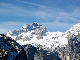
 Triglav viewed from the east | |
| Highest point | |
| Elevation | 2,864 m (9,396 ft) |
| Listing | Country high point Ultra |
| Coordinates | 46°22′42″N 13°50′12″E / 46.37833°N 13.83667°E |
| Naming | |
| English translation | three peaks |
| Geography | |
 | |
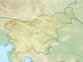
| Location | Littoral, Upper Carniola, Slovenia |
| Parent range | Julian Alps |
| Climbing | |
| First ascent | 1778 |
| Easiest route | scramble / via ferrata |
Triglav (pronounced [ˈtɾiːɡlau̯]; German: Terglau; Italian: Tricorno), with an elevation of 2,863.65 metres (9,395.2 ft),[1][notes 1] is the highest mountain in Slovenia and the highest peak of the Julian Alps. The mountain is the pre-eminent symbol of the Slovene nation, appearing on the coat of arms and flag of Slovenia. It is the centrepiece of Triglav National Park, Slovenia's only national park. Triglav was also the highest peak in Yugoslavia before Slovenia's independence in 1991.
- ^ a b Banovec, Tomaž (March 1986). "Triglav, 2864 metrov" [Triglav, 2864 meters]. Planinski Vestnik (in Slovenian). LXXXVI (3): 106.
- ^ "Kako visok je v resnici Triglav" [How High Is Triglav Actually?]. Siol.net (in Slovenian). 22 November 2016.
Cite error: There are <ref group=notes> tags on this page, but the references will not show without a {{reflist|group=notes}} template (see the help page).

