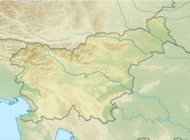
| Trnovo Forest Plateau | |
|---|---|
 The Trnovo Forest Plateau seen from Vipavski Križ | |
| Highest point | |
| Coordinates | 45°57′46″N 13°52′20″E / 45.96278°N 13.87222°E |
| Geography | |
| Location | Slovenia |
| Parent range | Dinaric Alps |
The Trnovo Forest Plateau[1] (Slovene: Trnovski gozd) is a karst plateau that constitutes the extreme northwest end of the Dinaric Alps.[2] The Trnovo Forest Plateau has a karst character, without surface watercourses and broken up by closed valleys, outcroppings, hills, caves, shafts, and smaller karst features: solution pans, rills, karrens, and other features. Significant karst features include ice caves. The vegetation inversion at Big Paradana Ice Cave (Slovene: Velika ledena jama v Paradani) in the eastern part of the plateau, measuring 385 meters (1,263 ft) by 1,550 meters (5,090 ft), is a locus classicus and in the past ice was harvested from it and exported via Gorizia and Trieste to Egypt.[3]
The Trnovo Forest Plateau has three nature reserves:[4]
- Big Paradana Ice Cave
- Golak Peaks (1,495 meters or 4,905 feet) and Spruce Valley (Slovene: Smrekova draga, a karst depression)
- The Smrečje forest reserve
The southern ridge of the Trnovo Forest Plateau is Čaven.
- ^ Nered, Janez, & Drago Perko. 2010. Na prelomnici: razvojna vprašanja Občine Idrija. Ljubljana: Založba ZRC, p. 51.
- ^ Perko, Drago, & Milan Orožen Adamič. 1998. Slovenija: pokrajine in ljudje. Ljubljana: Mladinska knjiga, p. 324.
- ^ Habič, Peter. 1992. Ledena jama. In: Enciklopedija Slovenije, vol. 6, p. 115. Ljubljana: Mladinska knjiga.
- ^ Odlok o spremembah in dopolnitvah prostorskih sestavin dolgoročnega in družbenega plana Občine Ajdovščina za območje Občine Ajdovščina. Official Gazette of the Republic of Slovenia, 30 August 2004.(in Slovene)
