Trondenes Municipality
Trondenes herred | |
|---|---|
 | |
 Troms within Norway | |
 Trondenes within Troms | |
| Coordinates: 68°49′18″N 16°33′48″E / 68.82167°N 16.56333°E | |
| Country | Norway |
| County | Troms |
| District | Central Hålogaland |
| Established | 1 Jan 1838 |
| • Created as | Formannskapsdistrikt |
| Disestablished | 1 Jan 1964 |
| • Succeeded by | Harstad Municipality |
| Administrative centre | Trondenes |
| Area (upon dissolution) | |
| • Total | 186.3 km2 (71.9 sq mi) |
| • Rank | #388 in Norway |
| Highest elevation | 987 m (3,238 ft) |
| Population (1963) | |
| • Total | 6,423 |
| • Rank | #128 in Norway |
| • Density | 34.5/km2 (89/sq mi) |
| • Change (10 years) | |
| Demonyms | Trondenesværing Tronesværing[1] |
| Official language | |
| • Norwegian form | Neutral[2] |
| Time zone | UTC+01:00 (CET) |
| • Summer (DST) | UTC+02:00 (CEST) |
| ISO 3166 code | NO-1914[4] |
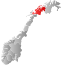
Trondenes is a former municipality in Troms county, Norway. The 186.3-square-kilometre (71.9 sq mi) municipality existed from 1838 until its dissolution in 1964. It was located along the western shore of the Vågsfjorden in what is now Harstad Municipality. Trondenes included the southern part of the island of Grytøya and part of the eastern coast of the island of Hinnøya as well as some smaller islands. Located just north of the town of Harstad, the village of Trondenes was the administrative centre of the municipality. That village is also the site of the historic Trondenes Church, the northernmost medieval stone church in Norway and the seat of the historic Trondenes parish. The Trondenes Historical Center was built in 1997 near the church to teach about the history of the area. Trondenes Fort is also located on the Trondenes peninsula.[5][6]
Prior to its dissolution in 1964, the 186.3-square-kilometre (71.9 sq mi) municipality was the 388th largest by area out of the 689 municipalities in Norway. Trondenes Municipality was the 128th most populous municipality in Norway with a population of about 6,423. The municipality's population density was 34.5 inhabitants per square kilometre (89/sq mi) and its population had increased by 37.3% over the previous 10-year period.[7][8]
- ^ "Navn på steder og personer: Innbyggjarnamn" (in Norwegian). Språkrådet.
- ^ "Norsk Lovtidende. 2den Afdeling. 1932. Samling af Love, Resolutioner m.m". Norsk Lovtidend (in Norwegian). Oslo, Norway: Grøndahl og Søns Boktrykkeri: 453–471. 1932.
- ^ "Forskrift om målvedtak i kommunar og fylkeskommunar" (in Norwegian). Lovdata.no.
- ^ Bolstad, Erik; Thorsnæs, Geir, eds. (26 January 2023). "Kommunenummer". Store norske leksikon (in Norwegian). Kunnskapsforlaget.
- ^ Thorsnæs, Geir, ed. (19 February 2018). "Trondenes – tidligere kommune". Store norske leksikon (in Norwegian). Kunnskapsforlaget. Retrieved 1 August 2018.
- ^ Helland, Amund (1899). "Trondenes herred". Norges land og folk: Tromsø amt (in Norwegian). Vol. XIX. Kristiania, Norway: H. Aschehoug & Company. p. 73. Retrieved 1 August 2018.
- ^ Statistisk sentralbyrå. "Table: 06913: Population 1 January and population changes during the calendar year (M)" (in Norwegian).
- ^ Statistisk sentralbyrå (1 January 1951). Norges Sivile, Geistlige, Rettslige og Militære Inndeling 1. Januar 1951 (PDF). Norges Offisielle Statistikk (in Norwegian). Oslo, Norge: H. Aschehoug & Co.