| Tropic Shale | |
|---|---|
| Stratigraphic range: Cenomanian to Turonian | |
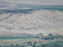
 Tropic Shale at its type location at Tropic, Utah | |
| Type | Geological formation |
| Unit of | Kaiparowits Plateau |
| Underlies | Straight Cliffs Formation |
| Overlies | Dakota Formation |
| Thickness | Maximum 1,450 feet (440 m), average 600 feet (180 m) |
| Lithology | |
| Primary | Shale |
| Location | |
| Coordinates | 37°37′44″N 112°04′34″W / 37.629°N 112.076°W |
| Region | |
| Country | |
| Type section | |
| Named for | Exposures near Tropic, Garfield County, Utah |
| Named by | Gregory and Moore, 1931[1] |
The Tropic Shale is a Mesozoic geologic formation. Dinosaur remains are among the fossils that have been recovered from the formation,[2] including Nothronychus graffami. The Tropic Shale is a stratigraphic unit of the Kaiparowits Plateau of south central Utah. The Tropic Shale was first named in 1931 after the town of Tropic where the Type section is located.[3] The Tropic Shale outcrops in Kane and Garfield counties, with large sections of exposure found in the Grand Staircase–Escalante National Monument.
- ^ Geolex — Unit Summary, USGS
- ^ Weishampel, et al. (2004). "Dinosaur distribution." Pp. 517-607.
- ^ Gregory, H.E. and Moore, R.C., 1931, The Kaiparowits region, a geographic and geologic reconnaissance of parts of Utah and Arizona: U.S. Geological Survey Professional Paper, 164, 161 p.

