Troutdale, Virginia | |
|---|---|
 Post office and bank | |
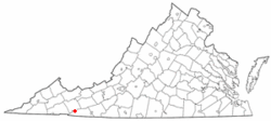
 Location of Troutdale, Virginia | |
| Coordinates: 36°42′3″N 81°26′41″W / 36.70083°N 81.44472°W | |
| Country | United States |
| State | Virginia |
| County | Grayson |
| Area | |
| • Total | 3.13 sq mi (8.10 km2) |
| • Land | 3.12 sq mi (8.09 km2) |
| • Water | 0.00 sq mi (0.00 km2) |
| Elevation | 3,127 ft (953 m) |
| Population | |
| • Total | 140 |
| • Estimate (2021)[2] | 140 |
| • Density | 53.14/sq mi (20.52/km2) |
| Time zone | UTC-5 (Eastern (EST)) |
| • Summer (DST) | UTC-4 (EDT) |
| ZIP code | 24378 |
| Area code | 276 |
| FIPS code | 51-79456[3] |
| GNIS feature ID | 2391451[4] |
Troutdale is a town in Grayson County, Virginia, United States.[4] The population was 140 at the 2020 census.[2]
- ^ "2019 U.S. Gazetteer Files". United States Census Bureau. Retrieved August 7, 2020.
- ^ a b c "City and Town Population Totals: 2020—2021". Census.gov. US Census Bureau. Retrieved October 7, 2022.
- ^ "U.S. Census website". United States Census Bureau. Retrieved January 31, 2008.
- ^ a b "Town of Troutdale". Geographic Names Information System. United States Geological Survey, United States Department of the Interior. Retrieved February 25, 2014.