| Tsimanampetsotsa National Park | |
|---|---|
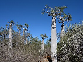
 Pachypodium geayi in Tsimanampetsotsa | |
Map of Madagascar | |
| Location | South-west Madagascar |
| Nearest city | Efoetsy, Toliara |
| Coordinates | 24°05′56″S 43°49′55″E / 24.099°S 43.832°E[1] |
| Area | 432 km2 (167 sq mi) |
| Established | 1927 |
| Website | parcs-madagascar |
| Official name | Parc national Tsimanampesotse |
| Designated | 25 September 1998 |
| Reference no. | 962[2] |
Tsimanampetsotsa National Park also spelt Tsimanampetsotse, and known as Tsimanampetsotsa Nature Reserve is a 432 km2[3] national park on the south-west coast of Madagascar in the region Atsimo-Andrefana. The park is 90 kilometres (56 mi) south of Toliara and 950 kilometres (590 mi) south of the capital, Antananarivo. Route Nationales (RN) 10 to Faux Cap passes the park and the nearest airport is at Toliara. The national park contains and is named after Lake Tsimanampetsotsa.
- ^ "Tsimanampetsotsa National Park". protectedplanet.net.
- ^ "Parc national Tsimanampesotse". Ramsar Sites Information Service. Retrieved 25 April 2018.
- ^ "Nationalpark Tsimanampetsotsa". 18 December 2006.
