| Tsipa | |
|---|---|
 | |
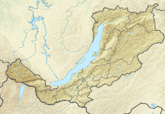
Mouth location in Buryatia, Russia | |
| Location | |
| Country | Russia |
| Physical characteristics | |
| Source | Southern Muya Range Stanovoy Highlands South Siberian System |
| • coordinates | 55°02′44″N 111°49′40″E / 55.04556°N 111.82778°E |
| • elevation | 1,950 m (6,400 ft) |
| Mouth | Vitim |
• coordinates | 55°22′44″N 115°55′57″E / 55.379°N 115.9325°E |
• elevation | 550 m (1,800 ft) |
| Length | 692 km (430 mi) |
| Basin size | 42,200 km2 (16,300 sq mi) |
| Basin features | |
| Progression | Vitim→ Lena→ Laptev Sea |
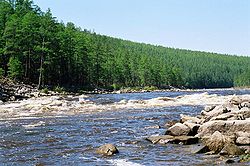
The Tsipa (Russian: Ципа) is the largest tributary of the Vitim in Buryatia, Russia. It is 692 kilometres (430 mi) long, and has a drainage basin of 42,200 square kilometres (16,300 sq mi).[1] Maksim Perfilyev was the first Russian to reach the Tsipa in 1640.[2]
Perch, pike, lenok, grayling, taimen and whitefish are also found in the waters of the Tsipa.[3]
- ^ "Река Ципа (Верх. Ципа, Ниж. Ципа) in the State Water Register of Russia". textual.ru (in Russian).
- ^ Lantzeff, George V., and Richard A. Pierce (1973). Eastward to Empire: Exploration and Conquest on the Russian Open Frontier, to 1750. Montreal: McGill-Queen's U.P.
{{cite book}}: CS1 maint: multiple names: authors list (link) - ^ Cite error: The named reference
WRwas invoked but never defined (see the help page).
