| Tsipikan | |
|---|---|
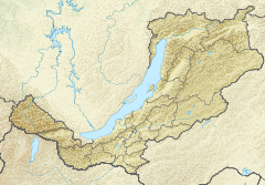
 Course of the Tsipikan | |
Mouth location in Buryatia, Russia | |
| Location | |
| Country | Russia |
| Physical characteristics | |
| Source | Ikat Range |
| • coordinates | 54°46′44″N 111°50′0″E / 54.77889°N 111.83333°E |
| • elevation | 2,107 m (6,913 ft) |
| Mouth | Tsipa |
• location | Baunt |
• coordinates | 55°12′55″N 113°05′13″E / 55.21528°N 113.08694°E[1] |
• elevation | 1,059 m (3,474 ft) |
| Length | 329 km (204 mi) |
| Basin size | 6,710 km2 (2,590 sq mi) |
| Discharge | |
| • average | 36.8 m3/s (1,300 cu ft/s) |
| Basin features | |
| Progression | Tsipa→Vitim→ Lena→ Laptev Sea |
The Tsipikan (Russian: Ципикан) is a river in Buryatia, Russia. It is the second largest tributary of the Tsipa, after the Amalat, of the Vitim basin.[2] The river is 329 kilometres (204 mi) long, and has a drainage basin of 6,710 square kilometres (2,590 sq mi).[3] There is gold mining in the banks of the river.
- ^ Google Earth
- ^ Tsipa - Water of Russia
- ^ "Река Ципикан in the State Water Register of Russia". textual.ru (in Russian).
