| Tsna | |
|---|---|
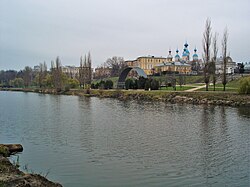
 The Tsna in the Tambov area | |
 | |
| Native name | Цна (Russian) |
| Location | |
| Country | Russia |
| Cities | Kotovsk, Tambov, Morshansk, Sasovo |
| Physical characteristics | |
| Source | |
| • location | Sampursky District, Tambov Oblast |
| • coordinates | 52°19′N 42°19′E / 52.317°N 42.317°E |
| Mouth | Moksha |
• location | Sasovsky District, Ryazan Oblast |
• coordinates | 54°28′11″N 42°01′56″E / 54.4697°N 42.0322°E[1] |
• elevation | 86 m (282 ft) |
| Length | 451 km (280 mi) |
| Basin size | 21,500 km2 (8,300 sq mi) |
| Discharge | |
| • average | 46 m3/s (1,600 cu ft/s) |
| Basin features | |
| Progression | Moksha→ Oka→ Volga→ Caspian Sea |
This article needs additional citations for verification. (August 2017) |
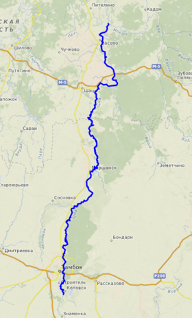
The Tsna (in its upper part: Mokraya Vershina) is a river in the Tambov and Ryazan oblasts of Russia, a left tributary of the Moksha (Volga basin). The length of the river is 451 km.[2] The catchment area is 21500 km².[2] The height of the mouth is 86 m above sea level.[3]
On the river are the cities of Kotovsk, Tambov, Morshansk, Sasovo.
It begins in the Sampursky District under the name of Mokraya Vershina.[4]
- ^ Volga at GEOnet Names Server
- ^ a b «Река ЦНА» — информация об объекте в Государственном водном реестре
- ^ Карта ГГЦ
- ^ Лист карты N-37-XXXVI Рассказово. Масштаб: 1 : 200 000. Состояние местности на 1980 год. Издание 1986 г.