| Tulung La | |
|---|---|
| Elevation | 17,250 feet (5,260 m) |
| Location | Tsona County, Tibet, China - Tawang, Arunachal Pradesh, India |
| Range | Himalaya |
| Coordinates | 27°52′57″N 92°15′04″E / 27.8825°N 92.2511°E |
 | |
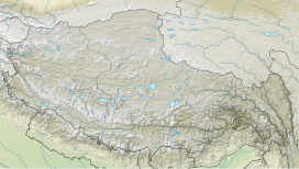
Tulung La[a] (Tibetan: ཐུ་ལུང་ལ་, Wylie: thu lung la)[4] is a border pass between the Tsona County in the Tibet region of China and India's Tawang district in Arunachal Pradesh. It is in the eastern part of the two districts, close to the Gori Chen cluster of mountains, on a watershed between the Tsona Chu river in Tibet and the Tawang Chu in the Tawang district. The watershed ridge forms the border between Tibet and India as per the McMahon Line.[1][5] Tulung La provided an invasion route to China during the 1962 Sino-Indian War. It is also the scene of occasional clashes between the two sides.
- ^ a b Bailey, Exploration on the Tsangpo (1914), p. 579.
- ^ Bailey, Exploration on the Tsangpo (1914), attached map.
- ^ Mehra, The McMahon Line and After (1974), p. 232.
- ^ "Geographical names of Tibet AR (China): Tibet Autonomous Region". KNAB Place Name Database. Institute of the Estonian Language. 3 June 2018.
- ^ Arpi, 1962 and the McMahon Line Saga (1997), pp. 96–97.
Cite error: There are <ref group=lower-alpha> tags or {{efn}} templates on this page, but the references will not show without a {{reflist|group=lower-alpha}} template or {{notelist}} template (see the help page).

