This article needs additional citations for verification. (August 2014) |
Tura | |
|---|---|
Town | |
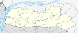
| Coordinates: 25°31′N 90°13′E / 25.52°N 90.22°E | |
| Country | India |
| State | Meghalaya |
| District | West Garo Hills |
| District council | GHADC |
| Elevation | 349 - 1,181.10 m (−3,526.0 ft) |
| Population (2011) | |
• Total | 74,858 |
| Languages | |
| • Regional | Garo |
| Time zone | UTC+5:30 (IST) |
| Telephone code | 03651 |
| Vehicle registration | ML 08 |
| Climate | Cwa |

Tura (IPA: ˈtʊərə) is a municipality in the West Garo Hills district of the Indian state of Meghalaya. One of the largest towns in Meghalaya, Tura is located in the foothills of the Nokrek range of Garo Hills. The climate in Tura is moderate throughout the year, and the town has many interesting and unexplored areas.
Tura is a cultural and administrative centre of the Garo tribe. It is also the district headquarters of the West Garo Hills district. It is filled with small rivulets and green valleys. The principal languages are Garo and English. The city has four colleges and multiple secondary schools.
