Tustin | |||||||||||||||
|---|---|---|---|---|---|---|---|---|---|---|---|---|---|---|---|
 Tustin station | |||||||||||||||
| General information | |||||||||||||||
| Location | 2975 Edinger Avenue Tustin, California | ||||||||||||||
| Coordinates | 33°42′29″N 117°48′22″W / 33.708°N 117.806°W | ||||||||||||||
| Owned by | City of Tustin | ||||||||||||||
| Line(s) | SCRRA Orange Subdivision[1] | ||||||||||||||
| Platforms | 2 side platforms | ||||||||||||||
| Tracks | 2 | ||||||||||||||
| Bus stands | 8 | ||||||||||||||
| Connections | |||||||||||||||
| Construction | |||||||||||||||
| Parking | 432 spaces, 8 accessible spaces[2] | ||||||||||||||
| Bicycle facilities | Racks, lockers | ||||||||||||||
| Accessible | Yes | ||||||||||||||
| History | |||||||||||||||
| Opened | January 18, 2002[3] | ||||||||||||||
| Services | |||||||||||||||
| |||||||||||||||
| |||||||||||||||
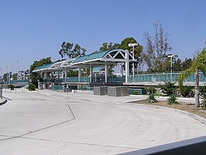
Tustin station is a Metrolink train station in Tustin, California, United States. The station is located in a shopping plaza at the intersection of Jamboree Road and Edinger Avenue.[citation needed] Between October 2010 and September 2011, the parking lot was closed to all cars to facilitate the construction of a five-level, 733-space parking structure. When combined with the 91 surface parking spaces, the station has 824 parking spaces, nearly tripling available parking on site.
OCTA buses and City of Irvine's iShuttle also services the station during peak commute hours. Amtrak's Pacific Surfliner passes through the station at 90 mph (140 km/h) and does not stop in Tustin. The nearest stations served by Amtrak are Irvine and Santa Ana.
- ^ SMA Rail Consulting (April 2016). "California Passenger Rail Network Schematics" (PDF). California Department of Transportation. p. 25.
- ^ "Tustin Train Station". Metrolink. Retrieved June 6, 2023.
- ^ Morin, Monte (January 18, 2002). "New Metrolink Station to Debut Today in Tustin". Los Angeles Times. ISSN 0458-3035. Retrieved July 5, 2019.
