| Twelve Bens/Benna Beola | |
|---|---|
 View of the range from Roundstone village. | |
| Highest point | |
| Peak | Benbaun |
| Elevation | 729 m (2,392 ft)[1] |
| Coordinates | 53°30′N 9°49′W / 53.50°N 9.81°W |
| Dimensions | |
| Area | 161.3 km2 (62.3 sq mi) |
| Naming | |
| Native name | Na Beanna Beola |
| English translation | The peaks of Beola[a] |
| Geography | |
| Location | Connemara, County Galway, Ireland |
| Provinces of Ireland | Connacht |
| Topo map | OSI Discovery 37, 44 |
| Geology | |
| Rock age | Precambrian-Cambrian |
| Rock type(s) | quartzites, grits, graphitic |
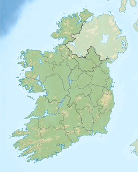
The Twelve Bens or Twelve Pins, also called the Benna Beola[2] (Irish: Na Beanna Beola, meaning 'the peaks of Beola'),[a] is a mountain range of mostly sharp-peaked quartzite summits and ridges in the Connemara National Park[b] in County Galway, in the west of Ireland.[4] The widest definition of the range includes the Garraun Complex to the north as well as several isolated peaks to the west, and is designated a 16,163-hectare (39,940-acre) Special Area of Conservation.[5]
The highest point is Benbaun at 729 metres (2,392 ft).[6] The range is a popular location for hill-walking activities with the 16–kilometre 8–9 hour Glencoaghan Horseshoe, considered one of the best ridge-walks in Ireland.[7][6] Topographically, the range is partnered with the Maumturks range to the east of the Inagh valley (a Western Way route);[6] and both share a common geology being largely composed of metamorphic marine rocks, being predominantly resistant quartzite but with deposits of schists in the valleys (known as Connemara Dalradian rocks).[8]
- ^ "Benbaun". MountainViews Online Database. Retrieved 8 February 2019.
- ^ "The Twelve Pins or Benna Beola" (English), Beanna Beola (Irish). Placenames Database of Ireland.
- ^ Tempan, Paul (February 2012). "Irish Hill and Mountain Names" (PDF). MountainViews.ie. pp. 17–18.
- ^ "Twelve Bens". Encyclopædia Britannica. Retrieved 6 March 2020.
- ^ Cite error: The named reference
gsiwas invoked but never defined (see the help page). - ^ a b c Cite error: The named reference
Dillon30was invoked but never defined (see the help page). - ^ Cite error: The named reference
Helen34was invoked but never defined (see the help page). - ^ Cite error: The named reference
ronanwas invoked but never defined (see the help page).
Cite error: There are <ref group=lower-alpha> tags or {{efn}} templates on this page, but the references will not show without a {{reflist|group=lower-alpha}} template or {{notelist}} template (see the help page).
