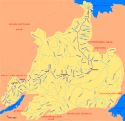
| Tyugyuene Тюгюэне / Түгүөнэ | |
|---|---|
 Basin of the Lena | |
Mouth location in Yakutia, Russia | |
| Location | |
| Country | Russia |
| Physical characteristics | |
| Source | |
| • location | Confluence of Ysyakh-Yuryage and Kupsuyu-Yuryakh Lena Plateau |
| • coordinates | 62°24′36″N 125°39′31″E / 62.41000°N 125.65861°E |
| • elevation | 300 m (980 ft) |
| Mouth | Lena |
• location | Near Kalvitsa |
• coordinates | 63°58′52″N 127°01′43″E / 63.98111°N 127.02861°E |
• elevation | 59 m (194 ft) |
| Length | 492 km (306 mi) |
| Basin size | 8,740 km2 (3,370 sq mi) |
| Basin features | |
| Progression | Lena→ Laptev Sea |
The Tyugyuene (Russian: Тюгюэне or Тюгене; Yakut: Түгүөнэ, Tügüöne) is a river in Yakutia (Sakha Republic), Russia. It is a tributary of the Lena with a length of 492 kilometres (306 mi) and a drainage basin area of 8,740 square kilometres (3,370 sq mi). The river marks the border between Gorny and Kobyaysky Districts in a stretch of its middle course.[1]
The name of the river is based on the Evenk word "tagin" (тагин), meaning "swamp".[2]
- ^ "Топографска карта P-51,52; M 1:1 000 000 - Topographic USSR Chart (in Russian)". Retrieved 11 January 2021.
- ^ Cite error: The named reference
RVRwas invoked but never defined (see the help page).
