Udham Singh Nagar | |
|---|---|
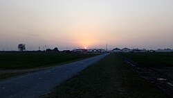
Clockwise from top-left: Palace of Dronacharya, Gurudwara Nanakana Sahib in Kashipur, Baigul Dam, Crops Research Center at Pantnagar, Metropolis city in Rudrapur | |
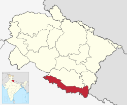
 Location in Uttarakhand | |
| Coordinates: 28°59′N 79°24′E / 28.98°N 79.40°E | |
| Country | |
| State | Uttarakhand |
| Division | Kumaon |
| Founded by | Udham Singh Nagar has been carved out of Nainital. |
| Named for | Udham Singh |
| Headquarters | Rudrapur |
| Government | |
| • District Magistrate | Mr. Uday Raj Singh, IAS[1] |
| Area | |
• Total | 3,055 km2 (1,180 sq mi) |
| Population (2011)[3] | |
• Total | 1,648,902 |
| • Density | 540/km2 (1,400/sq mi) |
| Languages | |
| • Official | Hindi[4] |
| • Additional official | Sanskrit[5][6] |
| • Regional | Khari Boli, Kumaoni, Tharu, Punjabi, Bengali, Urdu, Bhojpuri |
| Time zone | UTC+5:30 (IST) |
| Vehicle registration | UK 06, UK 18 |
| Website | usnagar |
Udham Singh Nagar is a district of Uttarakhand state in northern India. Rudrapur is the district headquarter. The district consists of nine Tehsils named Bajpur, Gadarpur, Jaspur, Kashipur, Khatima, Kichha, Nanakmatta, Rudrapur, Sitarganj. The district is located in the Terai region, and is part of Kumaon Division. It is bounded on the north by Nainital District, on the northeast by Champawat District, on the east by Nepal, and on the south and west by Bareilly, Rampur, Moradabad, Pilibhit and Bijnor District of Uttar Pradesh state. The district was created on 29 September 1995,[7][8] by Mayawati government out of Nainital District. It is named for freedom fighter and Indian revolutionary Udham Singh.[9]
As of 2011, it is the third most populous district of Uttarakhand (out of 13), after Haridwar and Dehradun.[3]
- ^ "District Magistrate Of Udham Singh Nagar | District Udham Singh Nagar, Government Of Uttarakhand | India". Retrieved 10 May 2024.
- ^ "DISTRICT UDHAM SINGH NAGAR AT A GLANCE" (PDF). Retrieved 10 May 2024.
- ^ a b Cite error: The named reference
Cesnsus2011Govwas invoked but never defined (see the help page). - ^ "52nd Report of the Commissioner for Linguistic Minorities in India" (PDF). nclm.nic.in. Ministry of Minority Affairs. p. 18. Archived from the original (PDF) on 25 May 2017. Retrieved 22 December 2018.
- ^ Trivedi, Anupam (19 January 2010). "Sanskrit is second official language in Uttarakhand". Hindustan Times. Retrieved 30 August 2017.
- ^ "Sanskrit second official language of Uttarakhand". The Hindu. 21 January 2010. Retrieved 30 August 2017.
- ^ धामी, भगवान सिंह (2021). यूकेपीडिया. देहरादून: समय साक्ष्य. p. 162. ISBN 978-93-90743-32-2.
- ^ सकलानी, शक्ति प्रसाद (1996). तराई रुद्रपुर का इतिहास और विकास. दिल्ली: गौरव प्रकाशन. p. 473.
- ^ Singh, Anand Raj (12 March 2015). "Mayawati may create new district to tame old foe". The New Indian Express. Archived from the original on 4 June 2016. Retrieved 14 May 2016.


