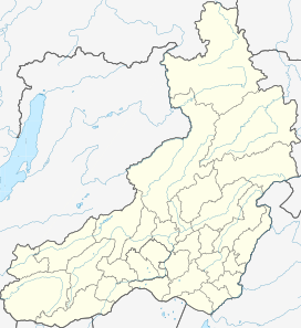
| Udokan Range хребет Удокан | |
|---|---|
 Remnants of ancient volcanic activity in the western Udokan Range. | |
| Highest point | |
| Peak | Unnamed |
| Elevation | 2,570 m (8,430 ft) |
| Coordinates | 56°40′20″N 119°07′32″E / 56.67222°N 119.12556°E |
| Dimensions | |
| Length | 210 km (130 mi) SW / NE |
| Width | 50 km (31 mi) |
| Geography | |
| Country | Russia |
| Federal subject | Zabaykalsky Krai / Yakutia / Amur Oblast |
| Range coordinates | 56°50′N 119°20′E / 56.833°N 119.333°E |
| Parent range | Stanovoy Highlands South Siberian System |
| Geology | |
| Age of rock | Precambrian |
| Type of rock | Gneiss, crystalline schist, volcanic rock |
| Climbing | |
| Easiest route | From Chara Airport |
The Udokan Range (Russian: хребет Удокан) is a mountain range in Sakha Republic (Yakutia) and Zabaykalsky Krai, Russian Federation.[1] The nearest town is Chara.[2]
There is copper mining in the range at the Udokan mine, part of the Udokan Ore Region that includes the Kalar and Kodar ranges.[3] A stretch of the Baikal–Amur Mainline passes through the range following the valley of the Khani river.[2]
- ^ "Удокан, хребет" [Udokan, mountains] (in Russian). Энциклопедия Забайкалья. Retrieved 21 September 2021. (in Russian)
- ^ a b Google Earth
- ^ Udokan Ore Region / Great Soviet Encyclopedia: in 30 vols. - Ch. ed. A.M. Prokhorov. - 3rd ed. - M. Soviet Encyclopedia, 1969-1978.
