| Ugar Brzica | |
|---|---|
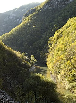
 Ugar river, at the bottom of its deep canyon | |
 | |
| Location | |
| Country | Bosnia and Herzegovina |
| Canton | Srednja Bosna |
| Physical characteristics | |
| Source | |
| • location | Prelivode, Vlašić Mt. |
| • coordinates | 44°20′38″N 17°39′22″E / 44.34397°N 17.6561°E |
| • elevation | ~1,590 m (5,220 ft) |
| Mouth | |
• location | Vrbas |
• coordinates | 44°27′12″N 17°14′20″E / 44.45345°N 17.23890°E |
• elevation | 268 m (879 ft) |
| Length | 44.5 km (27.7 mi) |
| Basin size | 328 km2 (127 sq mi) |
| Discharge | |
| • location | Mouth |
| • average | 6.98 m3/s (246 cu ft/s) |
| Basin features | |
| Progression | Vrbas→ Sava→ Danube→ Black Sea |
| Tributaries | |
| • right | Ugrić, Pljačkovac, Ilomska, Kobilja, Zirin potok, Kusin potok |
| Waterfalls | several |
The Ugar (Serbian Cyrillic: Угар, known as the Brzica until 1878)[1] is a river of Bosnia, a tributary of the Vrbas river. It originates at the slopes of Vlašić, upstream of Sažići and Melina villages (at around of 1,590 meters above sea level), a watershed area of Vrbanja, Ilomska and Bila rivers. The valley along the Ugar is known as Pougarje.

- ^ Džaja M. (1995): Pougarje i njegova okolica. Monografija.
