Uhrichsville, Ohio | |
|---|---|
 Third Street downtown | |
| Nickname(s): Twin Cities (see also Dennison, Ohio), Clay Capital of the World | |
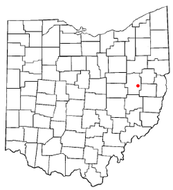
 Location of Uhrichsville, Ohio | |
 Location of Uhrichsville in Tuscarawas County | |
| Coordinates: 40°23′19″N 81°20′22″W / 40.38861°N 81.33944°W | |
| Country | United States |
| State | Ohio |
| County | Tuscarawas |
| Township | Mill |
| Area | |
| • Total | 2.84 sq mi (7.36 km2) |
| • Land | 2.84 sq mi (7.35 km2) |
| • Water | 0.00 sq mi (0.01 km2) |
| Elevation | 860 ft (260 m) |
| Population (2020) | |
| • Total | 5,272 |
| • Density | 1,857.65/sq mi (717.19/km2) |
| Time zone | UTC-5 (Eastern (EST)) |
| • Summer (DST) | UTC-4 (EDT) |
| ZIP code | 44683 |
| Area code | 740 |
| FIPS code | 39-78176[3] |
| GNIS feature ID | 2397079[2] |
| Website | https://www.cityofuhrichsville.org/ |
Uhrichsville(/ˈɜːrɪksˌvɪl/ UR-iks-vil[4]) is a city in Tuscarawas County, Ohio, United States. The population was 5,272 at the 2020 census.
Claymont City School District is the public school district of Uhrichsville and Dennison, Ohio. The twin cities is a nickname used to describe Uhrichsville and Dennison because they are adjacent.
- ^ "ArcGIS REST Services Directory". United States Census Bureau. Retrieved September 20, 2022.
- ^ a b U.S. Geological Survey Geographic Names Information System: Uhrichsville, Ohio
- ^ "U.S. Census website". United States Census Bureau. Retrieved January 31, 2008.
- ^ "E.W. Scripps School of Journalism Ohio Pronunciation Guide | Ohio University". www.ohio.edu. Ohio University. 2016. Retrieved December 23, 2022.